Complete Guide to Forgotten Path
Rediscover the Forgotten Way, an ancient Jacobean route before the French Way. From Bilbao or Pamplona, it traverses the north mountains of Spain until Villafranca del Bierzo.
Last updated: 28/03/2026
Table of Contents
Technical Summary of Forgotten Path
498 km
Distance
21
days
21
Stages
Alta
Difficulty
99 accommodations available on the route
Introduction to Forgotten Path
With a journey that exceeds 500 km, it is an demanding route, with solitary stretches and significant inclines, but of exceptional landscape beauty and historical value. Its recent revival attracts pilgrims seeking less crowded routes with a strong adventure component.
All Stages of Forgotten Path
Complete route divided into 21 stages
Bilbao to Guémené
The first stage of the Forgotten Way from Bilbao is a transitional journey that takes the pilgrim out of the great city. The route is demanding, with an initial strong climb to leave the valley of Bil...
Guémené in Navarre
This stage enters the heart of Las Encartaciones, in a medium mountain terrain. The profile is demanding, with several ascents and descents. The route passes through the historic village of Balmaseda,...
River of Ordunte to Bercedo
This stage enters the Mena Valley in Burgos province. The profile is of medium mountain, with a continuous rise and fall through a landscape of green meadows, forests, and small traditional villages. ...
Bercesto in Quintanilla del Rebollar
This stage continues through the Las Merindades region, on medium mountain terrain. The profile is undulating, with an ascent to Cabrio Pass. The landscape is of great beauty, with oak and beech fores...
Quintanilla del Rebollar to Soncillo
This stage is a long journey that crosses the Valdebezana valley. The profile is smoother than in previous days, with a terrain of gentle undulations. The landscape is of great beauty, with meadows, f...
Spring at Arroyo de Valdearroyo
This stage marks the entry into Cantabria. It is a day of great beauty that approaches the birthplace of the Ebro River. The profile is undulating, with an ascent to the Puerto de Carrales. The landsc...
Stream of Valdearroyo to Olive
This stage continues to border the Ebro reservoir, on a terrain of gentle undulations. It is a day of great scenic beauty, with water and mountains as main characters. The route passes through small C...
Olvea del Pino (also known as Olvea de Aguilera or simply Olvea) is not found in Aguilar de Campoo. However, I can suggest that you are referring to "Olea de Aguilera" which is a municipality located in the province of Cantabria, Spain. The translation would be:
This stage marks the return to Castile and León, to the province of Palencia. The profile is predominantly descending, an enjoyable stroll that ventures into the Palentine Mountains. The landscape is ...
Agullar de Campoo to Cervera de Pisuerga
This stage is a total immersion in the Palentine Mountains. The profile is demanding, with continuous ups and downs through high mountain landscapes of great beauty. The route enters the Fuentes Carri...
Cervera de Pisuerga to Santibañez de la Peña
This stage continues through the Palentine Mountains on demanding terrain. The route passes over a beautiful landscape with forests, valleys and views of the summits. It is a day of great solitude, id...
San Baltasar de la Pena to Puente Almohay
This stage marks the transition from Palencia province to León province. The profile is smoother, with a gradual descent into Cea River valley. The landscape remains of great beauty, with forests and ...
Bridge of Almuhey to Cisterna
This stage is an enjoyable stroll that follows the course of the Esla River. The profile is predominantly descending and flat, allowing for a relaxed walk. The riverbank landscape, with its chimneys a...
Cistern of Boñar
This stage enters the Central Leonesa Mountains. The profile is demanding, with continuous ups and downs through a landscape of great beauty. The route passes through oak and beech forests, and offers...
To defecate at La Robla
This is one of the hardest and most spectacular stages of the Forgotten Way. The journey involves crossing the Cantabrian Mountains with an ascent to a considerable altitude. The landscape is alpine, ...
Robla to Magdalena
The Magdala to Rielo
I don't have the translation for "Riello a Fasgar". Can you provide more context or information about this phrase?
Feast of Iglesias
Ibiza to La Benidorm
Labanejo to Congosto
Congost to Villafranca del Bierzo
This stage enters the Limia region, a territory of great natural and cultural wealth. The profile is a gentle rise and fall. The route passes through a landscape of forests, meadows and villages with ...
Key Towns of Forgotten Path
The most important towns and cities on this route.
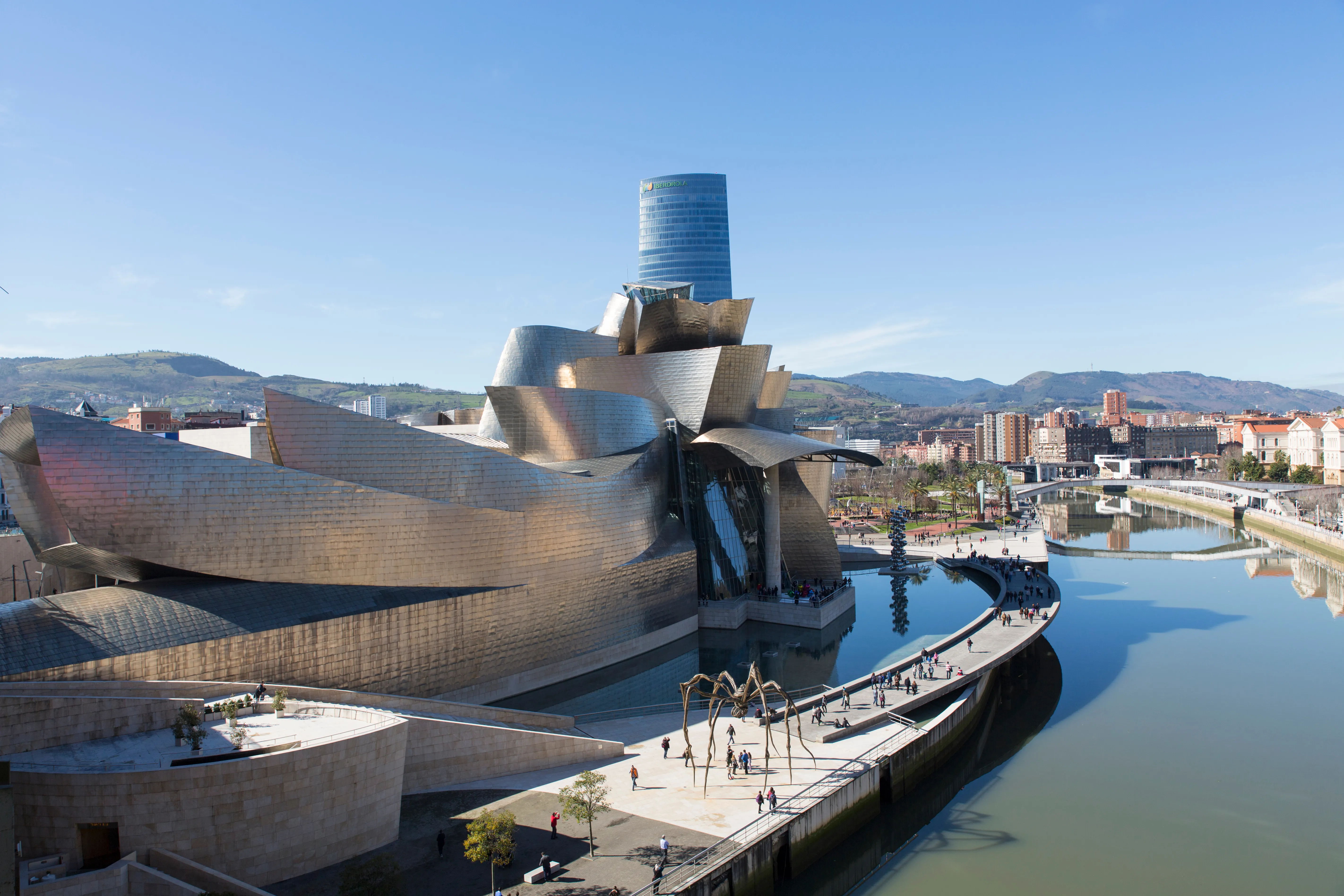
Bilbao
Vibrant start of the North Way. Bilbao offers the pilgrim a cosmopolitan beginning of the route marked by the Guggenheim Museum, its bay and exquisite pintxos cuisine.
Güeñes
60 mGüeñes, with its heritage of tower houses and its peaceful atmosphere, is a rural stop on the routes that cross the Encartations.
Nava de Ordunte
500 mSmall village on the border between Biscay and Burgos. Nava de Ordunte is a haven of peace on the Forgotten Way, perfect for enjoying nature in a mountain setting.
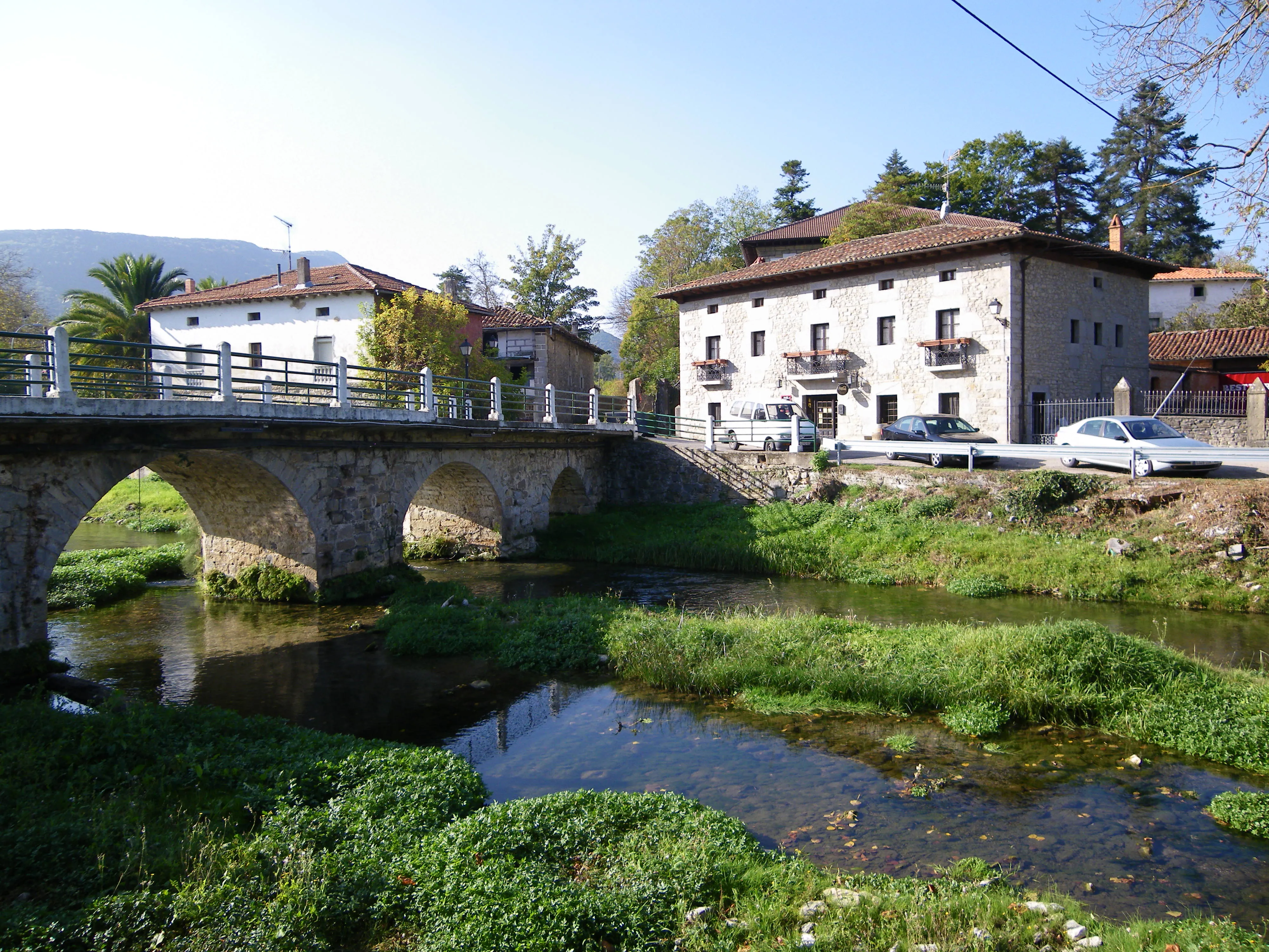
Bercedo
650 mBurgess town in the lush Valley of Mena. Bercedo is a rural stop with charm on the Forgotten Path, ideal for a break in a privileged natural setting.
Quintanilla del Rebollar
850 mQuintanilla del Rebollar, in the Forgotten Path, offers a rural retreat with mountain views and a peaceful atmosphere.
Soncillo
900 mService center in the valley of Valdebezana. Soncillo on the Forgotten Path is a functional stop with a rural atmosphere and a history linked to Jacobean tradition.
Arroyo de Valdearroyo
950 mCantabrian village on the banks of the Ebro River. The stream, alongside the dam, offers a pilgrim of the Forgotten Way a landscape of water and mountain of great beauty and tranquility.
Olea
980 mOlea is a rural stop on the Forgotten Path, offering the serenity of the mountain and a beautiful landscape.
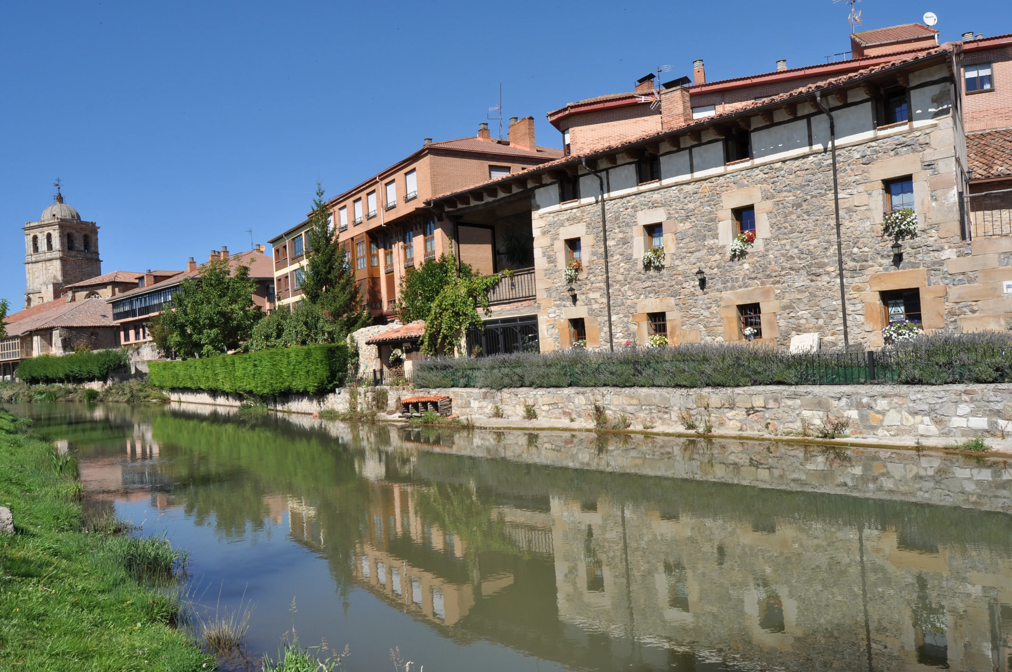
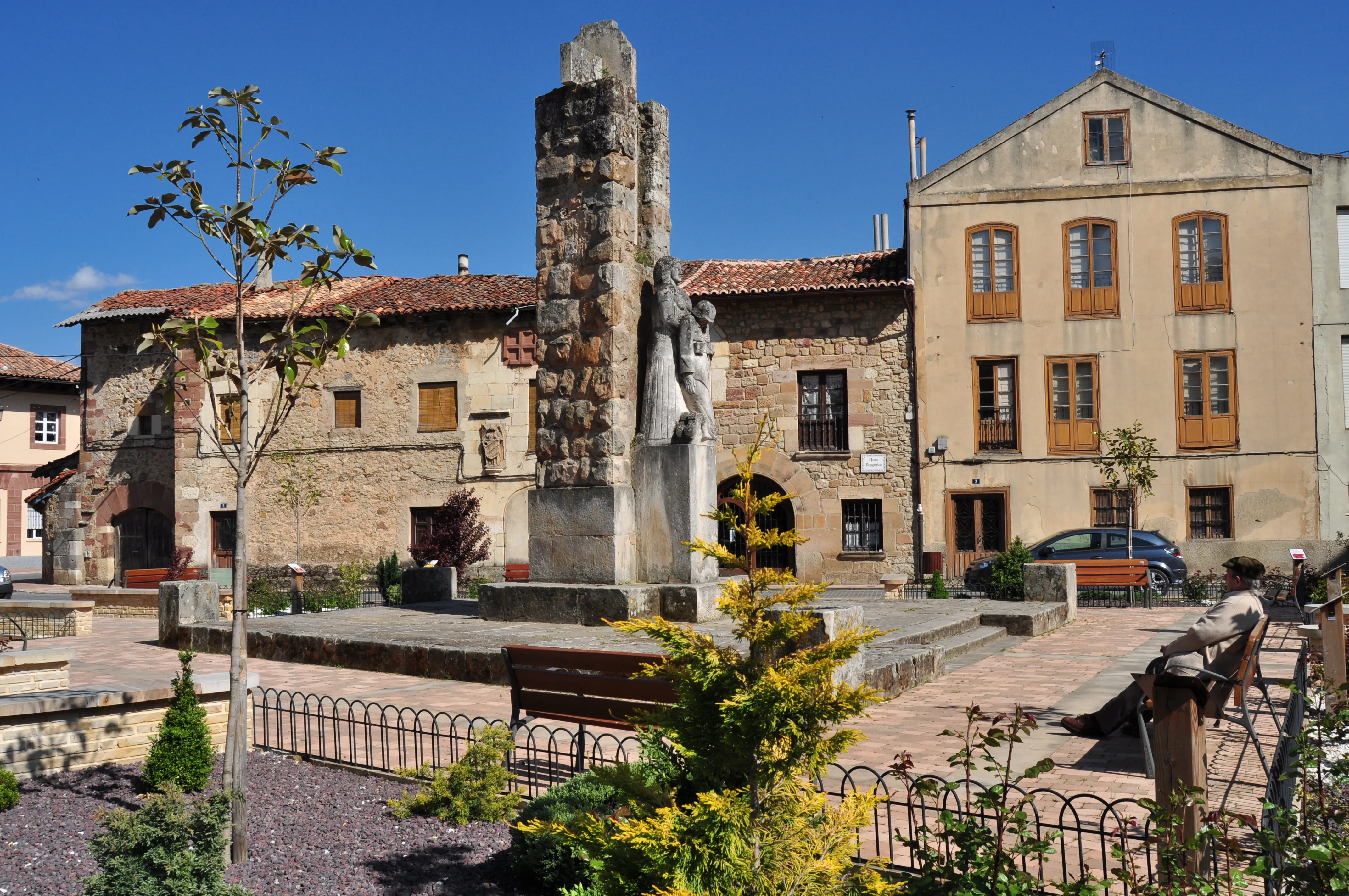
Aguilar de Campoo
Capital of Romanesque Palentine and the best galician village in excellence. Aguilar de Campoo is a monumental stop and sweet on the Forgotten Way, at the feet of the Palantine Mountain.
Cervera de Pisuerga
Capital of the Palatine Mountains. Cervera de Pisuerga is the entrance to the Fuentes Carrionas Natural Park, a paradise for nature lovers, hikers and Romanesque enthusiasts.
Santibáñez de la Peña
1050 mMine villa in the Palentine Mountains. Santibañez of the Peak, on the Forgotten Path, offers a landscape marked by its industrial past and a beautiful natural environment.
Puente Almuhey
1020 mLeonese village in eastern mountains. The Almuhey bridge, on the banks of the River Cea, is a charming stop with rural charm and services on the Route of Forgotten.
History of Forgotten Path
In the early centuries after the discovery of the Apostle's tomb, the Iberian Peninsula was a territory in constant conflict. Christian kingdoms clung to the north, and the border with Al-Andalus was an unstable and dangerous line. For the first pilgrims, both locals and those arriving from Europe at the Vascos ports, the most logical and safe route was not to venture into open plains, but to seek shelter in the mountains. The Forgotten Path offered precisely that: a natural corridor protected by geography, which connected the emerging Lordship of Vizcaya with the Leonese Bierzo through the mountainous comarcas of northern Burgos, southern Cantabria, and northern Palencia.
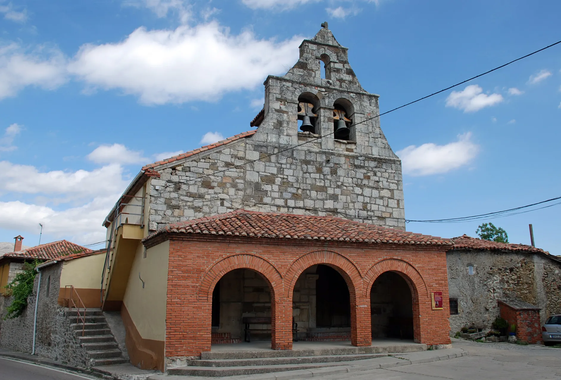
This route not only offered physical security but also connected important monastic and power centers of the time, which acted as beacons of civilization and refuge for travelers. It passed by strategic enclaves such as the Monastery of San Salvador de Oña in Burgos, a royal pantheon of great influence, or the village of Aguilar de Campoo in Palencia, now considered the capital of Romanesque art due to the incredible concentration of churches and hermitages in its surroundings. These holy places offered hospitality and solace to pilgrims on a route that, while safe from incursions, was not exempt from the hardships of high mountain: cold, snow, wolves, and long stretches without population.
The path's layout is a clear reflection of its mountainous character. Starting from points like Bilbao or Balmaseda, it ventured into the valleys of Las Merindades of Burgos, crossed the Ebro by Valderredible in Cantabria, and faced the ports of the Palentine and Leonesa Mountains. It was an demanding path, with constant ascents and descents, that required great physical and spiritual strength.
The "forgetfulness" of this path began in the 12th century. With the advance of the Reconquista and the determined promotion of Navarre and Castile kings, the French Way, more to the south and considerably flatter, became the new "highway of faith". With better infrastructure, greater royal protection, and the impulse of the Cluny Order, the route diverted the main flow of pilgrims. The Mountain Path was relegated to local use or for travelers who knew the terrain well. As the centuries passed, its memory faded from the general map of pilgrimages, although it never disappeared completely from the memory of the people that traversed it.
Its rediscovery and recovery in the 21st century is an authentic labor of pedestrian archaeology. Historians and friends of the Camino associations have dedicated years to investigating ancient documents, charters, and maps to reconstruct its original route, signaling it again for contemporary pilgrims. Today, the Forgotten Path offers a Jacobean experience of overwhelming authenticity. It's a solitary, hard, and wild path that allows the walker to connect with the essence of medieval pilgrimage and discover landscapes and Romanesque heritage of incalculable value, before converging near Villafranca del Bierzo with the French Way. Walking it is, in some way, unearthing forgetfulness and doing justice to one of the first paths that led men to Santiago.
Accommodations on the Route
The Forgotten Path has 99 verified accommodations along the entire route.
View Stages & AccommodationsPractical Tips for Forgotten Path
Best Season
Spring (April-June) and autumn (September-October) are the best seasons. Pleasant temperatures and fewer crowds than summer.
Physical Preparation
Train by walking progressively in the months before. Start with short distances and increase. Your body will adapt to the rhythm of the Camino.
What to Pack
Light backpack (max 10% of your weight), worn trekking shoes, breathable technical clothing, raincoat, sunscreen and basic first aid kit.
General Tips
Carry the pilgrim credential, stay hydrated, respect your pace, book accommodation in high season and enjoy the journey without rushing.
FAQ about Forgotten Path
El Camino Olvidado, también conocido como Viejo Camino de Santiago, es una ruta jacobea de 498 km que suele recorrerse en aproximadamente 21 días. Esta antigua ruta atravesaba las montañas del norte de España desde Bilbao o Pamplona hasta Villafranca del Bierzo.
La mejor época para realizar el Camino Olvidado es durante la temporada media, específicamente en abril-junio o septiembre-octubre. Durante estos meses, disfrutará de un clima agradable y una menor afluencia de peregrinos. En mayo, los campos están verdes con flores, mientras que en septiembre aún hay calor suave pero menos gente que en el verano.
El Camino Olvidado es considerado de alta dificultad debido a sus tramos montañosos, desniveles importantes y terrenos solitarios. Es necesario estar físicamente bien preparado, con una condición adecuada para caminar largas distancias en condiciones desafiantes.
Los costos del paquete completo de Ourway Travel para el Camino Olvidado pueden variar según la temporada, servicios incluidos y otros factores. Para obtener un presupuesto exacto, recomendamos ponerse en contacto directamente con nosotros para una cotización personalizada.
El paquete de Ourway Travel para el Camino Olvidado incluye alojamiento asegurado, traslados de equipaje y asesoramiento personalizado. Además, nuestros expertos gestionan todas las reservas necesarias y proporcionan información detallada sobre la ruta.
Para reservar el Camino Olvidado con Ourway Travel, simplemente completa nuestro formulario de contacto en línea o llámanos directamente. Uno de nuestros expertos se pondrá en contacto contigo para discutir tus necesidades y proporcionarte una cotización personalizada.
El Camino Olvidado es uno de los itinerarios más antiguos y menos masificados, ofreciendo un viaje histórico y aventurero en las montañas del norte de España. A diferencia del popular Camino Francés, el Olvidado atrae a peregrinos buscando una experiencia más auténtica y menos turística.
La credencial de peregrino es un documento necesario que puedes conseguir en oficinas de Turismo, iglesias o tiendas especializadas. Ourway Travel también puede asistirte proporcionando información detallada y recomendaciones sobre dónde obtenerla antes de tu viaje.
Ready for this adventure?
Let us organize your pilgrimage. We take care of accommodations, transfers and everything you need.